Organize by Location
Your phone already stamped the GPS coordinates into every shot. FolioSort
reads them, turns them into real place names, and files your whole library into folders like
Japan/Tokyo or Iceland/Reykjavík — then writes the place into the photo
itself, so your editor reads it too. Automatically, and without a single photo leaving your
computer.
Every time you take a photo on your phone, it quietly records exactly where you were. That trip through five countries, the summer at the lake, the city break — the coordinates are all sitting there in the EXIF, invisible and unused.
But raw coordinates are useless as folders. Nobody wants a folder called 35.6764, 139.6500. And
the tools that can show a map — Google Photos, Apple Photos — lock the location inside their app and
hand you nothing you can file, back up or move to another drive.
FolioSort reads the GPS coordinates from each photo and reverse-geocodes them into proper place names — city, country and state — that you can use directly as folder names.
Drop {City}, {Country} or {State} into a folder template and your whole
library reorganizes itself by place: your Tokyo shots go in Tokyo, your Iceland shots in Iceland, all in real
folders on your own disk that any app on any OS can read.
And it stays private. To turn coordinates into names, FolioSort sends only the latitude and longitude — never your photos — to a geocoding service. The images never leave your computer.
To write the place names into the photos themselves — and to give a location to camera photos that have none, from the phone photos taken around them — see Places.
How it works
Choose the folder, drive or SD card of photos you want to organize by place.
FolioSort reads the GPS coordinates from each photo's EXIF and reverse-geocodes them into city, country and state.
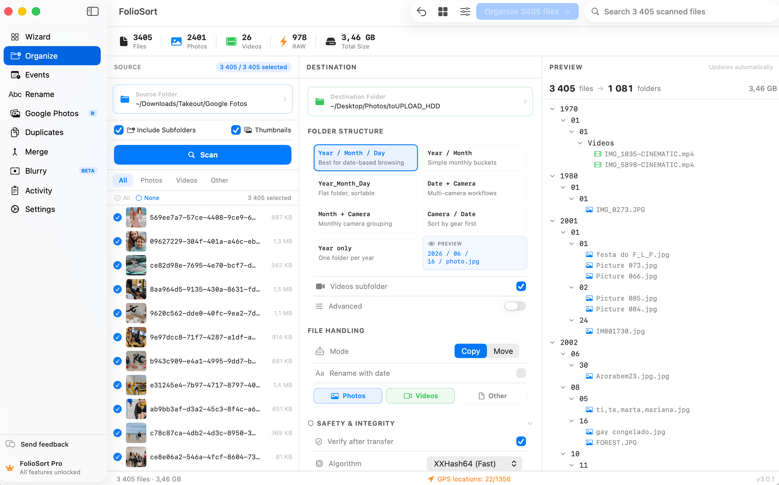
Add {City}, {Country} and {State} tokens — alone or mixed with date and camera — and preview the exact folder tree before anything moves.
Run it. Every photo lands in its place-based folder, checksum-verified, with one-click undo if you change your mind.
Location tokens
{Country}/{City}The classic travel archive — every trip filed under where it happened.{YYYY}/{City}/{YYYY}-{MM}-{DD}Year first, then place, then day — great for frequent travellers.{Country}/{City}/{Camera}Sort a multi-camera shoot by location and body in one pass.{State}/{City}Perfect for road trips and domestic travel across regions.{Lat} / {Lon}The raw coordinates, for filing that is geographic rather than administrative — a grid of dive sites, survey plots or field stations that no city name describes.Beyond the folder tree
A folder called Portugal/Lisboa is a fact about your disk. It is not a fact about the
photograph, and it does not survive somebody moving the file, importing it into a catalogue, or opening the
archive in twenty years with software nobody has written yet.
Reverse geocoding has always resolved your coordinates into a city and used the name to label things — folders, file names, the list on screen. It never put the word inside the file. Only the second one leaves with the photo.
Once the city names are on screen beside your own photos, FolioSort offers to write them into the files:
IPTC:City, Province-State and Country-PrimaryLocationName, plus the
matching XMP-photoshop fields — so Lightroom, Bridge, Capture One and digiKam read the place
straight out of the photograph.
You see the plan first, grouped by place with a count against each. Twelve places with numbers is a review somebody actually performs; a thousand rows of IMG_1234 → Lisboa is not, and a wrong city hides in the middle of it.
JPEG, HEIC and DNG are written in place. Every other RAW gets an .xmp sidecar beside it, so
not one byte of the original RAW is touched. The whole run has its own undo, and it needs no destination
folder — improving the files where they already sit is the entire point for anyone who is not reorganising
anything.
Reverse geocoding needs a lookup service to turn numbers into names — but that lookup only ever sees a pair of coordinates, never an image. Your library stays entirely on your machine.
On macOS, FolioSort uses Apple's built-in CLGeocoder. On Windows,
it uses OpenStreetMap's Nominatim service — again, coordinates only. No account, no photo upload,
no cloud storage of your library.
Once FolioSort files your photos by place, the result is real folders on disk — readable by Finder, File Explorer, your NAS, and any app on any operating system, forever.
No catalog, no proprietary database, no subscription holding your organization hostage. Move the folders to a new drive and the structure comes with them. It's your archive, in a form that outlives any single app.
I'd travelled through eleven countries in two years and my photos were one giant undated pile. FolioSort read the GPS out of every shot and rebuilt the whole thing as Country then City folders in about twenty minutes. I can finally find the Kyoto photos without scrolling for an hour.
Location is one axis of the FolioSort Organizer. Sort by real capture date, geocode by place, and rename in bulk — combine them into the exact archive you've always wanted.
Batch-sort tens of thousands of photos by EXIF date, camera and custom folder templates.
Explore the Organizer → Pairs withGive every file a clean, consistent name with date, place and sequence tokens.
Explore Rename →Reverse-geocode GPS into city and country folders — on-device, in real folders.
This pageFAQ
Most phones and many cameras write GPS coordinates into each photo's EXIF metadata at the moment of capture. FolioSort reads those coordinates and reverse-geocodes them into a real place name — city, country and state — which you can then use as folder names.
No. Your photos never leave your computer. To turn coordinates into place names, FolioSort sends only the latitude and longitude — a pair of numbers — to a geocoding service: Apple's built-in CLGeocoder on macOS, or OpenStreetMap's Nominatim on Windows. The image files themselves are never transmitted.
Photos without GPS coordinates — older cameras, or shots where location was off — simply fall back to whatever the rest of your template specifies, such as date or camera. You can add an "Unknown Location" folder to your template so nothing is ever left behind.
Yes. Tokens mix freely. A template like {Country}/{City}/{YYYY}-{MM}-{DD} sorts by place first, then date; {YYYY}/{City}/{Camera} groups by year then location then camera. You build the exact hierarchy you want and preview it before anything moves.
Partly. Resolving your GPS into real place names is free, capped at 100 photos per scan — whether it gets your own towns right is not something you can tell from a screenshot, so the verdict is free and only the volume is limited. Writing those names into your photos is free too. What needs Pro is the location tokens that build folders out of them. Pro is a one-time €29.99 with no subscription and a 14-day money-back guarantee. Organizing by date is free to try up to 100 files per batch. No account.
Point FolioSort at your library, add a {Country}/{City} template, and watch years of
travel reorganize itself into real, place-based folders — checksum-verified, undoable, and never uploaded.